Using the Landsat Imagery Service
|
How do I download the image I need?
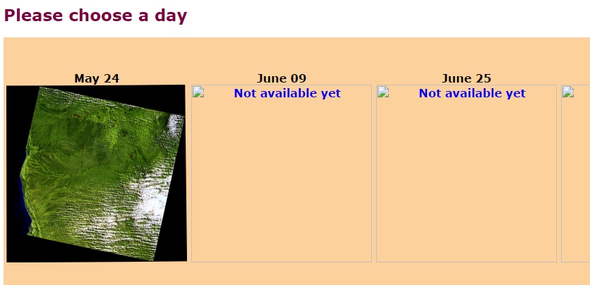
When you click on a rectangle on the Landsat map and select the "download image" link, you should see the gallery above which shows a small preview image of the satellite scene for each satellite pass since May 2017. There is one satellite pass every 16 days or so.
You can check these preview images for cloud cover to see if it is worth downloading. Clicking on the image will bring up a window with the download options.
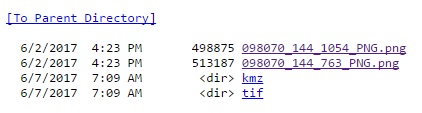
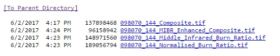
There are small png files for a quick look at the Landsat scene but the main options are kmz files in the kmz directory (for viewing in Google Earth) or larger tif files in the tif directory (for viewing in mapping programs). Go here for info on these file types. Just click on the directory link ("dir") with the file types you want - this will bring up a list of downloadable files.
The size of the file is the number to its left which is in bytes. So 513187 bytes is around 513KB. The tif files can be up to 1000MB in size. Click on the file name to download it to your computer. For more details on these file types go here. For queries email: aidan.joseph@cysf.com.au |